The $10 Million Deal That Drew America's Map
On December 30, 1853, the United States and Mexico signed the Gadsden Purchase, setting America's southern border and completing the continental map.
The United States bought its border the way you might buy a used car — haggling, in person, in Mexico City, on December 30, 1853. The seller was a desperate president. The buyer wanted room for a railroad.
The Mexican-American War had ended five years earlier, but the Treaty of Guadalupe Hidalgo left the border west of El Paso fuzzy: both countries claimed the Mesilla Valley. Meanwhile, Southern politicians and railroad men dreamed of a transcontinental line along a southern route to California — and such a route needed flat land south of the Gila River, land that was still Mexican.
President Franklin Pierce sent James Gadsden, his minister to Mexico, to buy it. Gadsden arrived with authorization to spend up to $50 million for a huge swath of northern Mexico, or $15 million for the smaller parcel the railroad actually needed. Mexico's president, Antonio López de Santa Anna, was broke and beset by rebellions. Gadsden bluntly suggested that the northern Mexican states might secede on their own before long — Santa Anna might as well sell while he could.
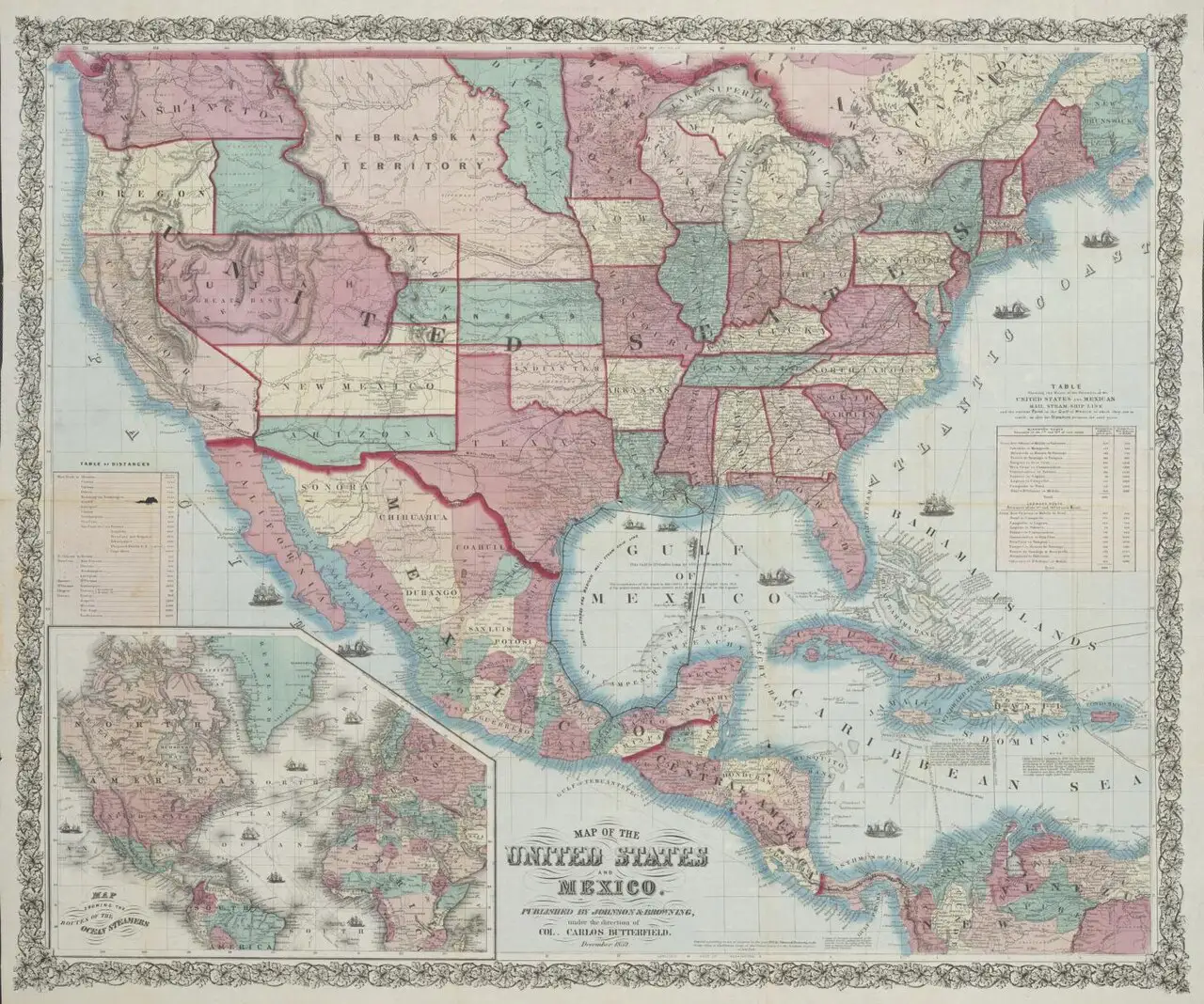
On December 30, 1853, the two men signed the treaty in Mexico City: $15 million for the needed territory. But the U.S. Senate thought the price too high and the parcel too generous. It ratified a trimmed version in April 1854 — roughly 30,000 square miles of what is now southern Arizona and New Mexico, for $10 million.
It was the last great land deal of American expansion — the final piece of the contiguous United States, drawn with a ruler-straight southern border that still stands today. The railroad the purchase was meant to serve eventually came too, binding the Southwest to the rest of the nation.
The railroad men got their way in the end, though not quite as planned. The driving force behind the purchase in Washington was Secretary of War Jefferson Davis — later president of the Confederacy — who wanted the southern route for strategic reasons. The Southern Pacific eventually laid its tracks across the purchased land in the early 1880s, and the towns that grew up along it — Tucson among them — owe their American addresses to Gadsden's haggle.
Every map of America you have ever seen gets its bottom-left corner from a haggle on December 30, 1853 — a reminder that borders are not found. They are negotiated, one desperate December at a time.
Photo: 1859 Johnson & Browning map of the United States and Mexico, public domain (via Wikimedia Commons).