
When a Mountain Blew Its Top: The 1980 Mount St. Helens Eruption
On May 18, 1980, a magnitude 5.1 earthquake triggered the eruption of Mount St. Helens, the most disastrous volcanic event in U.S. history, killing 57 people.
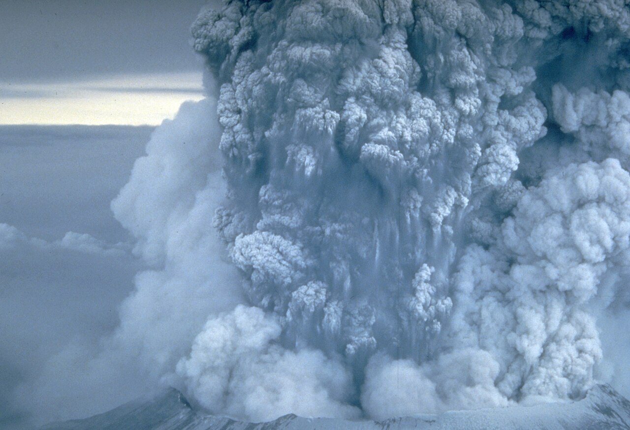
For two months the mountain had swelled like a held breath. Then, at 8:32 on a quiet Sunday morning, it exhaled.
Mount St. Helens, a picture-perfect peak in southwestern Washington, had been dormant since 1857 — so long that generations had grown up treating it as scenery. That changed in March 1980. A magnitude 4.2 earthquake struck on March 20; steam venting began on March 27. By the end of April, the north flank of the volcano had developed an ominous bulge as magma pushed up from below. By mid-May the bulge had grown outward some 450 feet, and more than 10,000 small earthquakes had been detected. The mountain was telling everyone exactly what was coming. Scientists camped at observation posts; officials closed the area to the public.
On May 18, 1980, at 8:32 a.m., a magnitude 5.1 earthquake shook the volcano. The entire weakened north face slid away — the largest landslide ever recorded — and that was only the beginning. With the mountain's pressure suddenly released, the hot, gas-charged magma exploded sideways in a devastating lateral blast, followed by towering pyroclastic flows. The top 1,300 feet of the peak collapsed or blew outward. An ash column rose 80,000 feet into the sky and drifted east for more than nine hours, dusting 11 states and parts of Canada. Melted glaciers and dammed lakes sent volcanic mudflows racing down the Toutle and Cowlitz rivers, destroying bridges and lumber camps all the way to the Columbia River, nearly 50 miles away. Roughly 230 square miles of forest were flattened in minutes.
Fifty-seven people were killed or remain missing. Among them was David Johnston, a 30-year-old geologist of the U.S. Geological Survey who was staffing an observation post on the day of the eruption. He knew the risk of staying — and stayed anyway, sending vital reports until the very end. His last radio message was the first anyone heard of the eruption: "Vancouver, Vancouver, this is it!" He, and the others who died that morning — loggers, photographers, campers, a retired innkeeper who refused to leave — are remembered at the observatory that now bears his name.
The eruption is often called the most disastrous volcanic event in American history, and it became the most closely studied eruption ever. It taught geologists how to read a restless volcano, how to forecast blasts, and how much a timely evacuation can save. The mountain itself tells the rest of the story: left alone to heal, the blast zone has slowly greened again, a living laboratory of recovery. Mount St. Helens is still active, still monitored around the clock — a reminder that geology works on its own schedule, and that paying attention to it is how we survive it.
Photo: U.S. Geological Survey (Donald A. Swanson), public domain (via Wikimedia Commons).