
The Day the Earth Moved for Five Minutes
On March 27, 1964, a magnitude 9.2 earthquake shook Alaska for nearly five minutes — the most powerful ever recorded in North America.
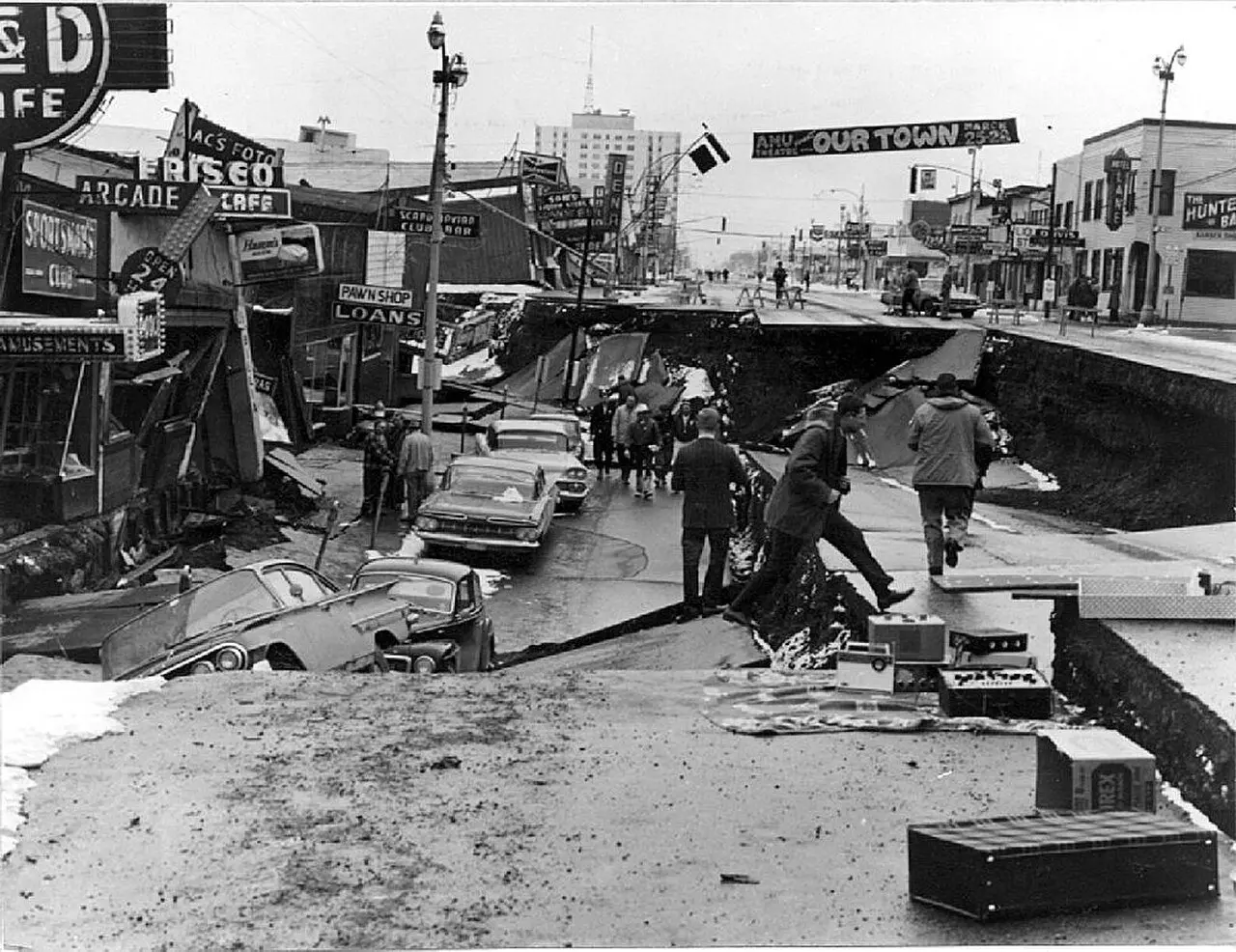
At 5:36 p.m. on March 27, 1964, the late-afternoon light was fading over south-central Alaska. It was Good Friday, and Anchorage — the state's largest city — was settling into the evening. Then the ground began to move, and it did not stop for nearly five minutes.
What struck Alaska that afternoon was a magnitude 9.2 megathrust earthquake, the most powerful ever recorded in North America and the second strongest in world history since modern seismography began. The fault that gave way ran for 600 miles beneath Prince William Sound, about 75 miles east of Anchorage, releasing the equivalent energy of nearly 2,000 magnitude-7 quakes. Some survivors said their first thought was that the Soviet Union had dropped a nuclear bomb.
In Anchorage, the shaking turned the earth to soup. A layer of clay beneath the city liquefied, and whole blocks of ground slid sideways. Along Fourth Avenue — the scene in this story's photograph — the street collapsed into a trench, buildings tilted and toppled, and cars sat stranded in the wreckage. Water, sewer, and power systems broke apart.
The land itself was remade. Near Kodiak, 200 miles southwest, the coastline rose permanently by 30 feet. Southeast of Anchorage, the ground around the head of Turnagain Arm dropped as much as 8 feet, drowning the old highway and forcing crews to rebuild it on fill above the new tide line.
But the shaking was only the beginning. The quake triggered a series of tsunamis. At Valdez, an underwater landslide collapsed the harbor and docks, killing 30 people, including those aboard a ship at the pier. A 27-foot wave destroyed the village of Chenega, killing 23 of its 68 residents — the survivors ran uphill ahead of the water. Whittier, Seward, and Kodiak were devastated. The waves traveled on: tsunamis killed and damaged people and property in Oregon and California, caused damage in Hawaii and Japan, and sloshed harbors as far away as Louisiana, where fishing boats capsized. In Seattle, more than 1,200 miles away, the Space Needle swayed. Water-level recorders in 47 states registered the quake. It was, scientists said, so large that it made the entire Earth ring like a bell.
Altogether, the earthquake and its tsunamis took about 139 lives and caused property losses estimated at $2.3 billion in modern dollars — though for the small Alaskan towns that had to rebuild from nothing, the true cost is not measured in dollars.
Why does this matter now? The 1964 quake was a hinge in science. The data it produced helped establish plate tectonics as accepted theory — the framework through which every subduction-zone earthquake is understood today. It transformed how cities build, how governments monitor seismic danger, and how tsunami warnings are issued. Every earthquake code, every early-warning system, every coastal evacuation route in America carries a little of Good Friday 1964 in its DNA.
And it is a reminder of scale: for nearly five minutes, one of the largest forces ever measured on Earth uncoiled beneath a state — and Alaska, town by town, got back up.
Photo: U.S. Army Corps of Engineers, public domain (via Wikimedia Commons).