Strange Sails on the Horizon: Captain Cook Sights Hawaii
On January 18, 1778, Captain James Cook's ships sighted Oahu, the first known European encounter with the Hawaiian Islands.
At dawn on January 18, 1778, lookouts on two British ships spotted something that appeared on no European map: green mountain peaks rising out of the empty Pacific. Captain James Cook had just stumbled onto Hawaii.
Cook wasn't looking for islands. On his third great voyage of exploration, commanding HMS Resolution and HMS Discovery, he had been sent by the British Admiralty to find a Northwest Passage — a sea route linking the Pacific to the Atlantic around the top of North America. He had already mapped New Zealand and the eastern coast of Australia on earlier voyages; now he was crossing the northern Pacific when land appeared where none should be.
On January 18, his ships sighted Oahu — the first known encounter between Europeans and the Hawaiian Islands. In the days that followed they coasted toward Kauai and Niihau, and on January 20 Cook anchored in Waimea Bay on Kauai's west coast. Hawaiians paddled out in canoes to meet the strange vessels, trading fish for whatever the sailors offered. Cook noted in his journal that they "exchanged a few fish they had in the Canoes for any thing we offered them, but valued nails, or iron above every other thing." A kahuna named Ku'ohu, seeing the great ships arrive during the sacred Makahiki festival season, declared them the floating temple of Lono, the god of fertility and agriculture.
Cook named the archipelago the Sandwich Islands, in honor of his patron John Montagu, the Fourth Earl of Sandwich and First Lord of the Admiralty. Before sailing on, he left the islanders gifts that would change their world: goats, pigs, and seeds for melons, pumpkins, and onions. The expedition continued north to Alaska, then returned to Hawaii that November. Cook would not leave alive — on February 14, 1779, he was killed in a confrontation at Kealakekua Bay on the island of Hawaii.
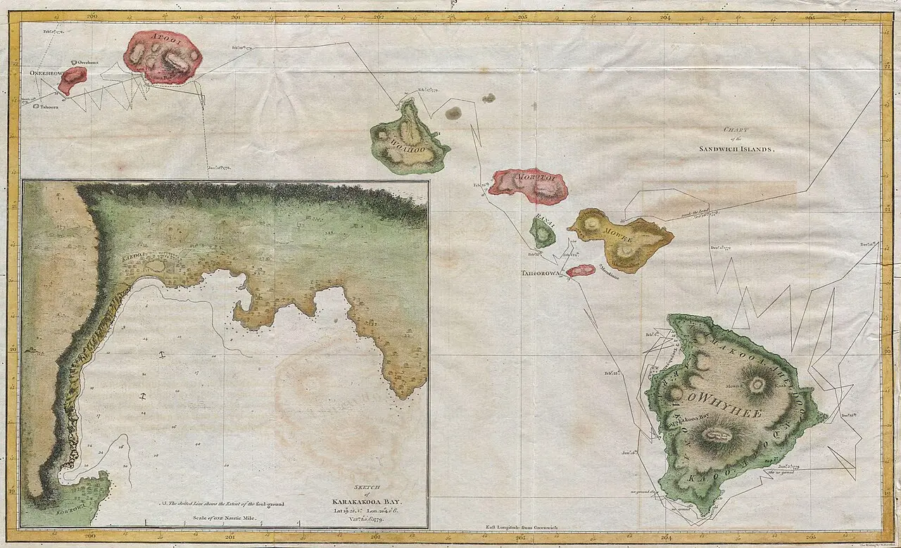
That January morning ended Hawaii's centuries of isolation. Cook's charts put the islands on the world's maps — they were published in the official three-volume account of his voyage in 1784 — and the contact he began reshaped Hawaii forever. Trade brought new goods and new foods; the animals and seeds Cook left behind multiplied; and in the decades that followed came missionaries, merchants, and eventually annexation. It is a story best remembered from both shores: for Europe, a triumph of navigation; for Hawaiians, the day the wider world arrived uninvited.
Image: a 1785 map of the Hawaiian (then "Sandwich") Islands, drawn from the charts of Captain Cook's third voyage and attributed to William Bligh — public domain, via Wikimedia Commons (courtesy of Geographicus Rare Antique Maps).